Overview
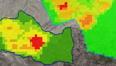
The Cross-Country Mobility (CCM) template contains tools for mounted and dismounted CCM analysis. The Mounted CCM tool combines the vehicle specifications with slope, surface roughness, vegetation, and soil information to estimate off-road speeds for vehicles. The Dismounted CCM tool estimates the rate that humans can travel during cross-country movement for day or night operations. This tool uses the individual's weight with slope, vegetation, soil factors, and surface roughness to do this calculation.
Requirements
Cross-Country Mobility requires specific technical experience and software. Minimum system requirements for the ArcGIS Platform can be found on the Support website.
| Requirement | Description |
| Experience |
|
| Software |
Map Authoring
|
What you get
When you download the Cross-Country Mobility template, the download includes the following:
| Directory | Folder | Item | Description |
| data | Layers | DismountedCCMOutput_MPH.lyr | This layer file is used to apply the desired symbology to the output from the Dismounted CCM tool. |
| MountedCCMOutput_KPH.lyr | This layer file is used to apply the desired symbology to the output from the Mounted CCM tool. | ||
| N/A | CrossCountryMobility.gdb | Contains the input area of interest feature class and examples of outputs from the tools. | |
| Environment.gdb | Contains the example input elevation data. | ||
| Scratch.gdb | Used to store intermediate datasets. | ||
| SupportingData.gdb | Contains the nonspatial tables used by the tools. | ||
| documentation | N/A | Using the Cross Country Mobility Template.pdf | PDF Document with instructions on how to get started with the template. |
| toolboxes | Scripts | DismountedCCM.py | Generates a dismounted Cross-Country Mobility raster product based on slope/speed characteristics, soil, and vegetation. |
| MountedCCM.py | Generates a mounted Cross-Country Mobility raster product based on the lowest common denominator for vehicle characteristics in a convoy, slope/speed characteristics, soil, and vegetation. | ||
| Cross Country Mobility Tools.tbx | Dismounted CCM | Generates a dismounted Cross-Country Mobility raster product based on slope/speed characteristics, soil, and vegetation. | |
| Mounted CCM | Generates a mounted Cross-Country Mobility raster product based on the lowest common denominator for vehicle characteristics in a convoy, slope/speed characteristics, soil, and vegetation. | ||
| N/A | N/A | CrossCountryMobility.mxd | A Map Document used to create the Cross-Country Mobility products. |
What's new
Below are the release notes for Cross-Country Mobility. If you'd like to get help from other military and intelligence community members, post your question on GeoNet.
| Version | Description |
| December 2016 |
|
| 3.0.0 |
|
| 2.0.0 |
|
| 1.0.0 |
|
You may be interested in
... related solutions that can be configured for your organization: