This item is now in mature support. For more information please visit the Esri Product Life Cycle page.
Overview
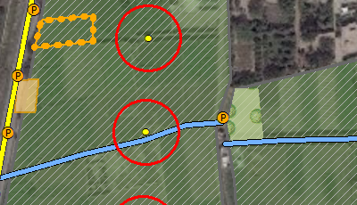
A helicopter landing zone (HLZ) is any specified zone used for the landing of helicopters. The Helicopter Landing Zone template provides a tool to create two feature classes containing possible touchdown point circles and center points for a selected aircraft.
Requirements
Helicopter Landing Zone requires specific technical experience and software. Minimum system requirements for the ArcGIS Platform can be found on the Support website.
| Requirement | Description |
| Experience |
|
| Software |
Map Authoring
|
What you get
When you download the Helicopter Landing Zone template, the download includes the following:
| Directory | Folder | Item | Description |
| data | layers | Various Layer Files | A folder that contains the layers to symbolize the outputs. |
| N/A | HelicopterLandingZone.gdb | Contains the example input data. | |
| Results.gdb | Used to store the output datasets. | ||
| Scratch.gdb | Used to store intermediate datasets. | ||
| documentation | N/A | Using the Helicopter Landing Zone Template.pdf | PDF Document with instructions on how to get started with the template. |
| toolboxes | Scripts | Various Python Scripts | Python scripts used in the creation of the HLZ Touchdown Points tool. |
| Helicopter Landing Zone.tbx | HLZ Touchdown Points | This tool identifies potential touchdown points for a specific aircraft within suitable landing areas. | |
| N/A | N/A | HelicopterLandingZone.mxd | A Map Document used to create the helicopter landing zone analysis product. |
What's new
Below are the release notes for Helicopter Landing Zone. If you'd like to get help from other military and intelligence community members, post your question on GeoNet.
| Version | Description |
| December 2016 |
|
| 4.0.0 |
|
| 3.0.0 |
|
| 2.0.0 |
|
| 1.0.0 |
|
You may be interested in
... related solutions that can be configured for your organization: