Overview
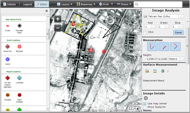

The Image Observables web application is a configuration of ArcGIS and JavaScript application designed to let you view imagery and easily record structured information about events and features.
A web map with one or more image services and feature services powers the Image Observables template. The feature service simplifies feature collection and enables storage of digitized features. Custom image analysis widgets in the application allow you to visually manipulate the image and perform mensuration and surface measurements.
Requirements
Image Observables requires specific technical experience and software. Minimum system requirements for the ArcGIS Platform can be found on the Support website.
| Requirement | Description |
| Experience |
Create App from Image Observables template
Deploy Web Application Template
|
| Software |
Map Authoring
GIS Service Hosting
Application Hosting
|
| Browser Compatibility |
|
What you get
When you download Image Observables, you'll find the following files:
| Directory | Item | Description |
| image-observables1.0 | site | A folder containing the Image Observables application files. |
| license.txt | A text file with the description of Apache License 2.0 terms and conditions. | |
| README.md | A markdown file with basic instructions, resources, and requirements for Image Observables. | |
| screenshot.png | A screenshot of Image Observables. This can be used as the thumbnail for the Portal for ArcGIS or ArcGIS Online item after deploying the application. |
What's new
Below are the release notes for Image Observables. If you'd like to get help from other military and intelligence community members, post your question on GeoNet.
| Date | Description |
| December 2016 |
|
| April 2014 |
|
You may be interested in
... related solutions that can be configured for your organization: