Overview

Incident Analysis can be used to identify patterns and trends of significant activity.
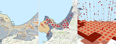
The Incident Analysis solution contains maps and tools that can be used to perform pattern and trend analysis and author situation maps showing incident locations and types of significant activity.
This solution does the following:
- Provides an example of an incident map
- Provides tools and layers needed to explore patterns and trends of past incidents
- Helps you create thematic maps and services using point symbols to represent your incident data
This solution is the starting point to discover spatial patterns and trends in significant activity in your area of interest. The tools included are:
- Cluster Analysis
- Count Incidents by Lines of Communication
- Find Percent Change
- Hot Spots by Area
- Incident Density
- Incident Hot Spots
- Create Space Time Cube in ArcGIS Pro
Requirements
Incident Analysis requires specific technical experience and software. Minimum system requirements for the ArcGIS Platform can be found on the Support website.
| Requirement | Description |
| Software |
Map authoring
|
What you get
When you download Incident Analysis, you will find the following:
| File | Folder | Description |
| IncidentAnalysis.zip | ArcGIS Pro | Folder containing an ArcGIS Pro project template to get you started with Incident Analysis workflows. |
| ArcMap | Folder containing sample data, toolboxes, and map document to get you started with Incident Analysis workflows. | |
| Resources | Supporting files for Incident Analysis. |
What's new
Below are the releases and notes for Incident Analysis. If you need support, please contact Esri Support Services. If you'd like to get help from other defense community members, post your question on GeoNet.
| Date | Description |
| September 2017 |
|
| June 2017 |
|