Each of the Local Government 3D Basemaps below are organized in different Levels of Detail (LOD) and derived from 2D operational data managed by a department or agency within a local government.
Basic Local Government Scene
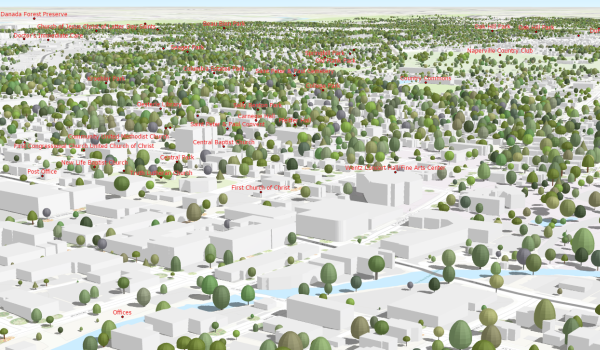
The Basic Local Government Scene is a LOD1 (Level of Detail) 3D scene. The scene includes the World Topographic Map draped over detailed elevation along with buildings and trees. Buildings and trees can be quickly generated with classified lidar (ground with first return) and used for massing visualization and conceptual planning. The Basic Local Government Scene is typically a combination of 2D and 3D operational layers used to support planning and public engagement needs.
Schematic Local Government Scene
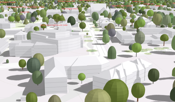
The Schematic Local Government Scene is a LOD2 (Level of Detail) 3D scene. The scene includes the World Topographic Map draped over detailed elevation along with LOD2 buildings, building floors, and trees. LOD2 building models have standard roof structures and can be generated in a semi-automatic way. High density lidar, preferably 2 foot point spacing or better, and manual building footprint segmentation are needed to model more complex roof structures. The Schematic Local Government Scene is similar to the Basic Local Government Scene but with more detailed roof structures and floor level information that makes it more useful for city management and planning. It provides context for in-depth city planning and supports more advanced building analysis like, zoning violation, development potential, shadow, visual impact, and solar exposure.
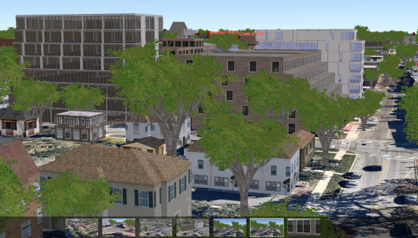
Realistic Local Government Scene
The Realistic Local Government Scene is a LOD3 (Level of Detail) 3D scene. The scene includes World Imagery draped over high resolution elevation along with textured LOD3 buildings and realistic trees. LOD3 building models have facade textures and can be generated by texturizing the LOD2 buildings from the Schematic Scene workflow. In addition, 3rd party LOD3 models can be loaded into the scene as well as realistic trees. The Realistic Local Government Scene is similar to the Schematic Local Government Scene but with again more detailed buildings and trees that makes it useful for city visualization, planning and citizen engagement.