This item has been moved to mature support. Please see What's new for more information.
Overview
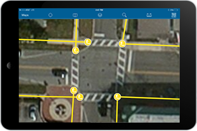
Sidewalk Inventory can be used to inventory public sidewalks and curb ramps.
The Sidewalk Inventory map helps public works staff develop a unified inventory of sidewalks, curb ramps, and their physical characteristics (for example, ramp type, slope and American with Disabilities Act compliance).
Requirements
To deploy Sidewalk Inventory with the ArcGIS Solutions Deployment Tool requires specific software.
| Requirement | Description |
| Software |
Solution deployment
Solution hosting
|
| Applications |
|
To manually deploy Sidewalk Inventory in your organization requires specific software.
| Requirement | Description |
| Software |
Map authoring
GIS service hosting
|
| Applications |
|
What you get
Sidewalk Inventory can be deployed in your ArcGIS organization without downloading the solution. When you deploy Sidewalk Inventory in your organization, you'll find the following:
| Item | Name | Description |
| Map | Sidewalk Inventory | A map used by field staff to inventory public sidewalks and curb ramps. |
| Feature layer | SidewalksCurbRamps | A feature layer used to store sidewalks along the street or in other public areas; and structures, commonly found at intersections, that provide access between the sidewalk and the street. |
What's new
Below are the release dates and notes for Sidewalk Inventory.
| Date | Description |
| November 2023 |
|
| January 2017 |
|
| June 2016 |
|
| December 2015 |
|
| July 2015 |
|
| December 2014 |
|
| June 2014 |
|