The Community Parcel solution can be used to produce a standard set of maps from aggregated parcel data and share these maps with community participants. Parcel communities can choose to deploy one or more maps in their organization and even extend these maps to meet their specific needs.
- Parcel Use
- Improved Structures
- Public Lands
- Improved Structure Value
- Land Value
- Mineral Lands
- Tax Exempt Property
- Rural Lands
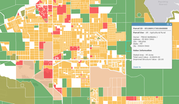
Parcel Use
The Parcel Use map can be used to visualize how land is occupied or utilized. The map is compiled from assessor use codes that are typically managed within a mass appraisal systems used for valuation purposes.
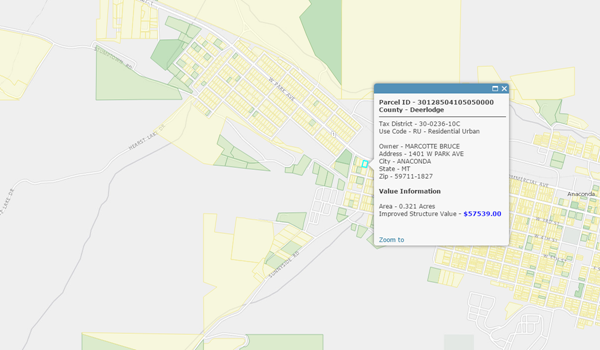
Improved Structures
The Improved Structures map can be used to visualize parcels that contain an occupied or unoccupied dwelling unit. The map is compiled from residential land use codes, and properties that have an assessed value greater than zero.
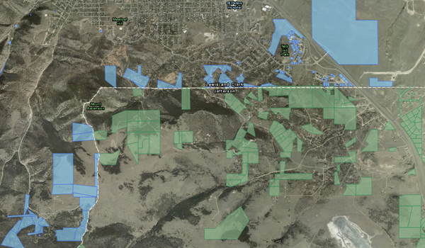
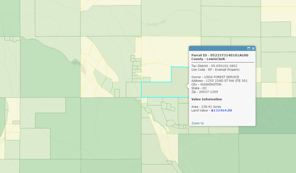
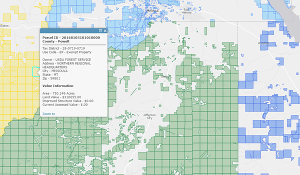
Public Lands
The Public Lands map can be used to visualize publicly owned (local, state, regional, federal, tribal, and so on) lands. The map is compiled from parcel use codes, assessed value, and owner name.
Improved Structure Value
The Improved Structure Value map can be used to visualize structure values. The map is compiled from parcels with improved structures and their improved value.
Land Value
The Land Value map can be used to visualize property values. The map is compiled from parcels and their land value.
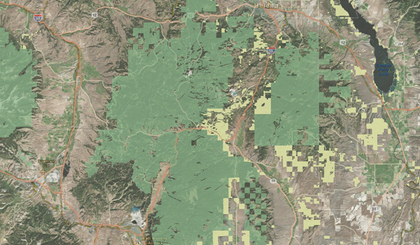
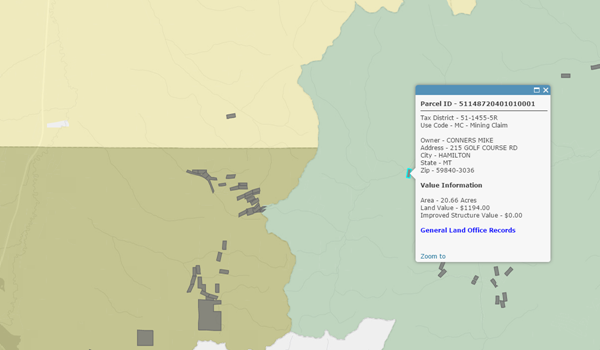
Mineral Lands
The Mineral Lands map can be used to visualize properties where surface and sub-surface mining operations are occurring. The map is compiled from assessor use codes that are typically managed within a mass appraisal systems used for valuation purposes.
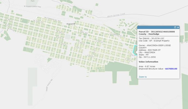
Tax Exempt Property
The Tax Exempt Property map can be used to visualize tax exempt properties (institutions, government owned properties, and other exempt properties). The map is compiled from exempt assessor use codes that are typically managed within a mass appraisal systems used for valuation purposes.
Rural Lands
The Rural Lands map can be used to visualize properties that do not have improved structures, deemed vacant, and are not being used for a particular purpose. The map is compiled from assessor use codes that are typically managed within a mass appraisal systems used for valuation purposes.