This item has been moved to mature support. Please see What's new for more information.

Overview

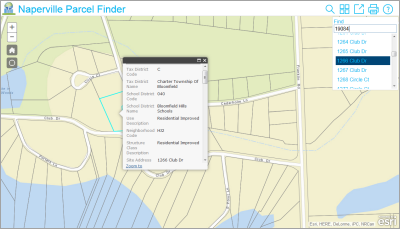
Finder is a configurable app template that searches and queries attributes of feature layers. It can be used to present information about a wide variety of features such as property tax and assessment information or the locations of water access points.

This application can be deployed by local, state, and national governments; utilities; NGOs and private industries; and can be used by staff or citizens on desktop computers, smartphones, and tablet devices.

Requirements

Requirement Description
Software
  • ArcGIS Online, Portal for ArcGIS, or ArcGIS Enterprise
Browser compatibility

What you get

The Finder application can be configured in ArcGIS Online or Portal for ArcGIS without downloading the application files. However, if you want to host the application on your own server or do additional configuration, the application files are available to download from GitHub.

Learn more about additional configuration options

What's new

Below are the release dates and notes for Finder.

Date Description
December 2016
  • Moved this application into mature support. To build an application with the properties of Finder, consider using the search widget in Basic Viewer or Web AppBuilder to build an application with equivalent searching, printing, and sharing capabilities.
  • Updated to use version 3.19 of the ArcGIS API for JavaScript.
September 2016
  • Updated to use version 3.18 of the ArcGIS API for JavaScript.
June 2016
  • Updated to use version 3.17 of the ArcGIS API for JavaScript.
February 2016
  • Updated to use version 3.16 of the ArcGIS API for JavaScript.
November 2015
  • Updated to use version 3.15 of the ArcGIS API for JavaScript.
July 2015
  • Updated to use version 3.14 of the ArcGIS API for JavaScript.
March 2015
  • Updated to use version 3.13 of the ArcGIS API for JavaScript.
December 2014
  • Updated to use version 3.12 of the ArcGIS API for JavaScript.
September 2014
  • Updated to use the 3.11 JavaScript API.
  • Improved handling of non-ASCII characters.
  • Added option for display of values from multiple fields in search results.
  • Added support for dynamic map services as basemaps.
  • Added support for an organization's print service when application is hosted in ArcGIS Online.
July 2014
  • A new application user interface.
  • Improved handling of coded domain values in pop-ups.
  • New documentation on the Solutions site.
  • Ability to specify a custom print service for web server implementations.
  • Updated to use the 3.10 JavaScript API.
  • Improved the thumbnail displayed for the web map basemap in the basemap widget.
  • Added functionality to clear the search result from the map when another feature is selected.

Get started with Finder

Top