This item has been moved to mature support. Please see What's new for more information.
Overview
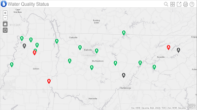
The Water Quality Status solution enables organizations to utilize water quality sampling information to provide constituents with the current status of water quality conditions for each waterway. Citizens can quickly determine if waterways or beaches, are fishable and swimmable.
The Water Quality Status application is a configuration of an ArcGIS Online configurable application template that can be accessed from smartphones, tablets, and desktop computers.
Requirements
| Requirement | Description |
| Experience |
|
| Software | Map authoring
GIS service hosting
|
| Applications |
|
What you get
When you download Water Quality Status, the download includes the following:
| Directory | Item | Description |
| MapsandGeodatabase | WaterQuality.mxd | A map document used to publish the WaterQuality service. |
| StateGovernment.gdb | State Government geodatabase with sample data. |
What's new
Below are the release dates and notes for Water Quality Monitoring.
| Date | Description |
| December 2016 |
|
| September 2016 |
|
| February 2016 |
|
| April 2014 |
|
You may be interested in
ArcGIS for State Government includes several related maps and apps that also can be configured in your organization: