User Guide
Load poles and publish
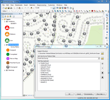
In order to begin using ArcGIS to conduct Joint Use Survey, the location of poles can be loaded into the provided schema. Once the poles are loaded, the results can be shared with your ArcGIS organization. Using an ArcGIS Desktop geoprocessing model, you can load poles and share the service. To create the joint use survey campaign, complete the following steps:
- Open the JointUseSurvey.mxd.
- Update the map document to your service area extent.
- Open the Joint Use toolbox.
- Run the Load Joint Use Data geoprocessing model, updating the model to use your pole data.
- Publish the map as a feature service and share with operations managers and field crews conducting joint use surveys.
Assign joint use surveys
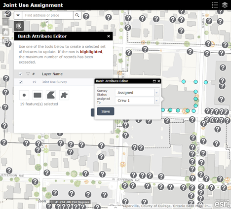
Using the Joint Use Survey Assignment app, operations managers can quickly sketch an area on the map and batch assign surveys in that area to a field crew. To batch assign joint use surveys, complete the following steps:
- Sign in to your ArcGIS organization.
- Browse to the Joint Use Survey Assignment app and open it in a new tab.
- Open the Survey Assignment widget.
- Sketch an area of the map. All poles within this area will be selected for the attribute update.
- Update the Survey Status and Assigned To fields.
- Save the changes.
Collect joint use data
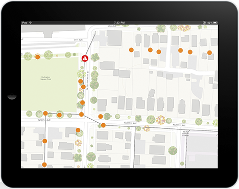
Field crews can view their assignments and collect data using Collector for ArcGIS. To record joint use data in the field, complete the following steps:
- Open Collector for ArcGIS on your mobile device and sign in to your ArcGIS organization.
- Browse to the Joint Use Survey map filtered for your field crew.
- Select an assigned joint use survey and add a new attachment or safety violation.
- Select an assigned joint use survey and edit the details. Be sure to update the Survey Status and Date Completed fields.
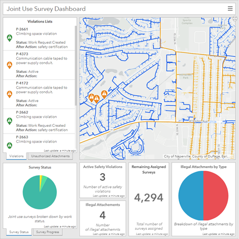
Monitor joint use surveys
The Joint Use Survey Dashboard allows operations managers to monitor the progress of joint use surveys. To monitor the surveys, complete the following steps:
- Sign in to your ArcGIS organization.
- Browse to the Joint Use Survey Dashboard and open in a browser.
- Use the widgets to learn more about the progress of the inventory, status of safety violations, and illegally attached pole attachments.