This item has been moved to mature support. Please see What's new for more information.

Overview

Nighttime Flow Overview

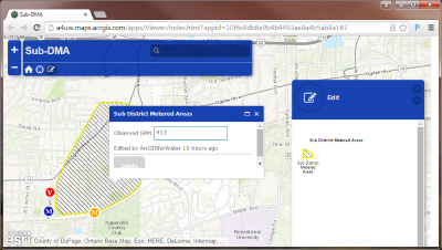
The Nighttime Flow Analysis solution provides water utilities tools to create, monitor, update, and retire a Sub-DMA for the purpose of identifying areas of potential high water loss. For additional details, please read Detecting Water Loss Early With ArcGIS - Using Nighttime Flow Analysis.

This solution includes a series of services, maps, and apps for use throughout your utility's organization.

Requirements

Nighttime Flow Analysis requires specific technical experience and software.

Requirement Description
Software
Geoprocessing
  • ArcMap (Advanced) 10.5 - 10.8
Map authoring
  • ArcMap (Advanced) 10.5 - 10.8
  • ArcGIS Pro (Standard or Advanced) 2.3 - 2.5
GeoEvent services
  • ArcGIS Enterprise (Advanced) 10.5 - 10.8
    • ArcGIS GeoEvent Server
Map service hosting
  • ArcGIS Online, or
  • ArcGIS Enterprise (Standard or Advanced) 10.5 - 10.8
Applications
  • Basic Viewer (ArcGIS configurable application template)
  • Impact Summary (ArcGIS configurable application template)
  • ArcGIS Dashboards
  • ArcGIS Web AppBuilder
Prerequisites
  • A water network published as a service

What you get

When you download Nighttime Flow Analysis, you'll find the following in the zip file:

Directory Item Description
Application ArcREST A folder containing the required Python package. This package is used in the DMA Planner toolbox to add features to a feature service.
AttributeAssistant.esriAddIn The Attribute Assistant provides a series of predefined methods to automatically populate attributes (ex. assign valve size based on the water main feature it intersects) when features are created and updated.
Maps and GDBs DMA.gdb A sample geodatabase with the DMA feature service schema..
WaterDistributionNetwork.gdb A sample geodatabase with water network data from the City of Naperville, Illinois.
DMAPlanner.tbx A toolbox with tools used to plan, share, and delete SubDMA data.
SubDMAPlanner.mxd A map document used for planning SubDMAs.
DMA Boundaries Locations.lyr A layer file used to symbolize the SubDMA Boundary Input feature set in the 1-SubDMA Planner geoprocessing model.
Trace Location.lyr A layer file used to symbolize the Select a pipe inside the DMA feature set in the 1-SubDMA Planner geoprocessing model.

What's new

Below are the release dates and notes for Nighttime Flow Analysis.

Date Description
June 2020
September 2018
  • Support for Operations Dashboard for ArcGIS configurable web app.
January 2018
  • The latest release of the Attribute Assistant Add-In. See release notes for more information.
  • An update to the Sub-DMA Valve and Meter List application to support the latest release of Operations Dashboard for ArcGIS.
  • An update to the Sub-DMA Planning geoprocessing model to support vertical coordinate systems.
June 2017
  • Nighttime Flow Analysis documentation updated for automated deployment with the ArcGIS Solutions Deployment Tool.
March 2017
July 2016
June 2016
  • The most recent release of the Attribute Assistant Add-In. See release notes for more information.
  • An enhancement to the Automated Setup to include the publishing of the Sub-DMA Status Updater application.
February 2016
  • Most recent version of the Automated Setup & Reporting tools. See the release notes for more details.
  • Most recent version of the Attribute Assistant add-in. See release notes for more details.
  • The most recent sample water network data from the Local Government Information Model.
  • An update to the Append Data to Feature Service model with new parameters and capabilities to work across multiple versions.
November 2015
  • Removal of the Batch Attribute Editor widget from the download; widget is now part of Web AppBuilder
  • Use of Web AppBuilder (Developer Edition) no longer required
August 2015
  • Batch Attribute Editor upgraded to Web AppBuilder (Developer Edition) 1.2
  • Latest versions of the ArcREST tools.
    • ArcREST version 3.
  • Config file enhancements.
July 2015
  • Load SubDMA to Service script now utilizes ArcMap's login to connect to the Feature Service
  • Latest release of the Attribute Assistant Add-In
  • The most recent sample water network data from the Local Government Information Model
  • Latest version of the Batch Attribute Editor widget (formally known as Batch Editor widget)
May 2015
  • Enhanced planning model to snap to valves and mains and reduces the snap tolerance
  • Latest versions of the ArcREST tools
    • ArcREST Helper is now included with ArcREST
  • Report modules moved to solutionreporttools python package
  • Config file schema changes
    • PublishData added to PublishingDetails section to allow the user to quickly bypass this entire section
    • EnableEditTracking & Capabilities parameters in FeatureServices has been replaced with the Definition section
March 2015
  • First release of Nighttime Flow Analysis

Get started with Nighttime Flow Analysis

Top