This item has been moved to mature support. Capabilities replaced with Lead Service Line Inventory.
Overview
Lead Service Management can be used to capture and manage information about lead service lines and inform the public about lead service line status in drinking water systems.
This solution includes two applications: one to inform the customers about lead and one with report generating capabilities to assist water utilities in keeping track of where the lead water service lines are located.
Requirements
To deploy Lead Service Management with the ArcGIS Solutions Deployment Tool requires specific technical experience and software.
| Requirement | Description |
| Software |
Solution deployment
Solution hosting
|
| Applications |
|
What you get
When you deploy Lead Service Management, you'll find the following:
| Item | Name | Description |
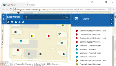
| Applications | Lead Viewer | An application used by the public to view the potential of lead material in their water service lines. |
| Lead Report | An application used by water utility personnel to create location reports of lead material in water service lines. | |
| Maps | Lead Viewer | A map used in the Lead Viewer application for the public to view the potential of lead material in their water service lines. |
| Lead Report | A map used in the Lead Report application for water utility personnel to create location reports of lead material in water service lines. | |
| Field Verification | A map used by water utility field personnel to verify the material of the water service line. | |
| Feature layer | Field Verification | A feature layer used to store asset information collected in the field. |
| Lead Services | A feature layer used to store water service line data. |
What 's new
Below are the release dates and notes for Lead Service Management.
| Date | Description |
| June 2021 |
|
| June 2018 |
|
| April 2018 |
|
| January 2018 |
|
| December 2017 |
|