This item has been moved to mature support. For more information please visit the Esri Product Life Cycle page.
Overview
Civil-Military Operations is an Esri Defense solution for Civil Affairs. The solution consists of Survey123 forms; configurable web apps; and dashboards for collecting, managing, and visualizing civil affairs engagements, population sentiment, and requests for information.
With this solution you can do the following:
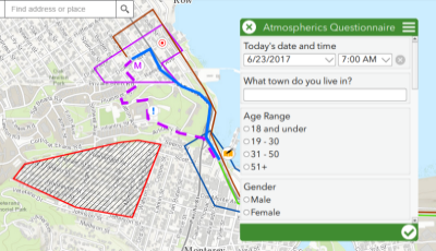
- Capture Atmospherics information from brief interviews.
- Capture Population Assessment Questionnaire Report (POPREP) information from in-depth interviews.
- Capture and manage Requests for Information (RFI).
- Plan the concept of operations (CONOP) for civil missions.
- Manage priority areas of interest and track civil affairs engagements.
- Manage the quality assurance process for data collected by civil affairs teams.
- Brief decision-makers on the status of civil-military operations in the field.
Requirements
Civil-Military Operations requires specific technical experience and software. Minimum system requirements for the ArcGIS platform can be found on the Support website.
| Requirement | Description |
| Experience |
|
| Software |
Survey Publishing
Using Surveys
Web Application Publishing and Configuring
Dashboard Configuring
|
Application |
|
Privileges |
|
What you get
When you download Civil-Military Operations, the download includes the following:
| Folder | Item | Description |
| RFI | RFI.xlsx | The XLSForm used for creating the Survey123 Connect form. |
| RFI.itemInfo | Summary and description contained in this file apply to the new form. | |
| RFI.png | Thumbnail image for the new form. | |
| POPREP | POPREP.xlsx | The XLSForm used for creating the Survey123 Connect form. |
| POPREP.itemInfo | Summary and description contained in this file apply to the new form. | |
| POPREP.png | Thumbnail image for the new form. | |
| Atmospheric | Atmospheric.xlsx | The XLSForm used for creating the Survey123 Connect form. |
| Atmospheric.itemInfo | Summary and description contained in this file apply to the new form. | |
| Atmospheric.png | Thumbnail image for the new form. | |
| Priority Areas of Interest and Operations | Priority_Areas_of_Interest_and_Operations.ppkx | The ArcGIS Pro Project Package used to create the Priority Areas of Interest and Operations web map and associated feature service and layers (Areas of Interest, and Operations). |
| Civil Mission Execution Planner | Civil_Mission_Execution_Planner.ppkx | The ArcGIS Pro Project Package used to create the Civil Mission Execution Planner web map and associated feature service and layers (Locations, Routes, and Areas). |
| Resources | Civil-Military Operations.pdf | Documentation to use with the solution. |