Overview
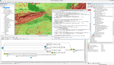

The Military Aspects of Terrain template is an example of terrain analysis for intelligence preparation of the battlefield (IPB). Along with weather and civil considerations, terrain is an integral part of many operations and can be critical in properly analyzing the battlefield environment. This template was built as an example of terrain analysis workflows, and how a Map Document can be used to configure ArcMap for specific tasks. The tools show you how to analyze the battlefield environment in an area of interest you specify. For example, it illustrates how you can:
- Use TDS data to publish an Obstacles and Lines of Communication map service
- Create map overlays for landing helicopters, off-road mobility, and concealment
- Make a Modified Combined Obstacle Overlay (MCOO) as Map Document or Web Map
Requirements
Military Aspects of Terrain requires specific technical experience and software. Minimum system requirements for the ArcGIS Platform can be found on the Support website.
Military Aspects of Terrain 1.0.1 is supported on ArcGIS 10.1.
| Requirement | Description |
| Experience |
|
| Software |
Map Authoring
GIS Service Hosting
|
What you get
When you download the Military Aspects of Terrain (MAoT) template, the download includes the following:
save| Directory | Folder | Item | Description |
| Documentation | N/A | Getting_Started_the_Military_Aspects_of_Terrain_template | PDF Document with instructions on how to get started (captured here) |
| Maps | Layers | Amphibious Landing Beaches (ALB).lyr | A layer with a schema and sample data for beaches suitable for amphibious landings. |
| Avenues of Approach.lyr | A layer with a schema and sample data for ground routes based on size. | ||
| Drop Zones (DZ).lyr | A layer with a schema and sample data for areas designated as a landing zone for parachutists. | ||
| Helicopter Landing Zones (HLZ).lyr | A layer with a schema and sample data for areas designated as a landing zone for helicopters. | ||
| Key Terrain.lyr | A layer with a schema and sample data for areas designated as advantageous in ground warfare. | ||
| Mobility Corridors.lyr | A layer with a schema and sample data for areas that canalize military forces based on size. | ||
| Packages | Avenues of Approach Features.lpk | A layer package with schema and sample data for ground routes based on size. | |
| Key Terrain Features.lpk | A layer package that identifies all key terrain in the Area of Operations. | ||
| Zones of Entry Features.lpk | A layer package that identifies all zones of entry in the Area of Operations. | ||
| N/A | OperationGDB.gdb | File Geodatabase | |
| Toolbox | A folder containing the MAoT Toolbox, layers, scripts, and scratch geodatabase. | ||
| Create MCOO.mxd | Map Document used to create a MCOO. | ||
| Create Suitability Overlays.mxd | Map Document used to create suitability overlays. | ||
| Publish LOC.mxd | Map Document used to publish lines of communication. | ||
| Publish Obstacles.mxd | Map Document used to publish obstacles. |
What's new
Below are the release dates and notes for Military Aspects of Terrain. If you need support, please contact Esri Support Services. If you'd like to get help from other military and intelligence community members, post your question on GeoNet.
| Version | Description |
| April 2018 | Military Aspects of Terrain solution is retired |
| 1.0.0 |
|
| 1.0.1 |
|
You may be interested in
... related solutions that can be configured for your organization: