Overview
The ArcGIS for Local Government Basemaps are a set of ArcMap documents that can be used to author high-quality, essential basemaps for your local government. These basemaps are the foundation of many of the ArcGIS for Local Government applications and provide a consistent geographic context across local government departments and agencies. They include important reference information to orient map users and are typically combined with operational information managed by a department and/or agency within local government.
Each basemap is provided as an ArcMap document organized around the ArcGIS Online/Bing Maps/Google Maps tiling scheme. The data frame in each map document is reprojected to the Web Mercator Auxiliary Sphere Projection (WKID 102100 / 3857), but the source data is maintained in its local projection.
Requirements
Local Government Basemaps requires specific software.
| Requirement | Description |
| Software |
Map authoring
GIS service hosting
|
What you get
When you download the Local Government Basemaps, you'll find the following files:
| Directory | Item | Description |
| Application | JPEG90CacheSettings.xml | A tiling scheme suitable for mobile basemaps. |
| MIXED90CacheSettings.xml | A tiling scheme suitable for the General Purpose, imagery, and land use basemaps. | |
| Campus90CacheSettings.xml | A tiling scheme suitable for the Campus basemap. | |
| MapsandGeodatabase | Campus.mxd | A map document used to publish the Campus tiled or cached service. |
| CurrentLandUse.mxd | A map document used to publish the Current Land Use tiled or cached service. | |
| FutureLandUse.mxd | A map document used to publish the Future Land Use tiled or cached service. | |
| GeneralPurpose.mxd | A map document used to publish the General Purpose tiled or cached service. | |
| ImageryReferenceOverlay.mxd | A map document used to publish the Imagery Reference Overlay tiled or cached service. | |
| MobileNight.mxd | A map document used to publish the Mobile Night tiled or cached service. | |
| MobileDay.mxd | A map document used to publish the Mobile Day tiled or cached service. | |
| PublicSafety.mxd | A map document used to publish the Public Safety tiled or cached service. | |
| Zoning.mxd | A map document used to publish the Zoning tiled or cached service. | |
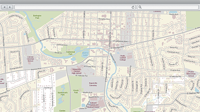
| LocalGovernment.gdb | ArcGIS for Local Government geodatabase with content from the City of Naperville, Illinois. | |
| Raster.gdb | A geodatabase with raster layers for the City of Naperville, Illinois. |
What's new
Below are the release dates and notes for Local Government Basemaps.
| Date | Description |
| June 2018 |
|
| March 2017 |
|
| June 2016 |
|
| December 2015 |
|
| July 2015 |
|
| December 2014 |
|
| June 2014 |
|
| June 2013 |
|
You may be interested in
ArcGIS for Local Government includes several related maps and apps that also can be configured in your organization: