Overview
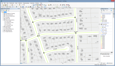
Road Network Management is a configuration of ArcMap that can be used by mapping technicians to inventory intersections, roads, and physical road characteristics (for example, speed limit, functional class, lane width, and number of lanes); and publish a series of road layers used in maintenance management and transportation planning workflows throughout a public works organization.
The Road Network Management solution is optimized for public works organizations and compliments address editing workflows provided in the Address Data Management map.
Requirements
Road Network Management requires specific software.
| Requirement | Description |
| Software |
|
What you get
When you download the Road Network Management solution, you'll find the following files:
| Directory | Item | Description |
| Application | AttributeAssistant.esriAddin | An ArcMap Add-in that includes the Attribute Assistant toolbar and a series of predefined methods to automatically populate attributes (for example, intersection identifier and street name) when features are created and updated. |
| MapsandGeodatabase | RoadCharacteristics.mxd | A map document used to publish RoadCharacteristics service. |
| RoadNetworkManagement.mxd | A map document used to maintain the public road network and associated characteristics. | |
| LocalGovernment.gdb | ArcGIS for Local Government geodatabase with content from the City of Naperville, Illinois. |
What's new
Below are the release dates and notes for Road Network Management.
| Date | Description |
| February 2020 |
|
| March 2019 |
|
| June 2018 |
|
| January 2018 |
|
| March 2017 |
|
| July 2016 |
|
| June 2016 |
|
| February 2016 |
|
| July 2015 |
|
| December 2014 |
|
| June 2014 |
|
There is a newer version...
Road Network Management (ArcMap) has been moved to mature support and replaced with Road Network Data Management (ArcGIS Pro).