Overview
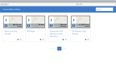
Events Map Gallery is a configuration of the Minimal Gallery application that can be used by the general public and visitors to review site maps developed for community, or special events. This application complements the Events Calendar and Event Site Map applications, and serves as a single destination for event maps that can be accessed on desktops computers, tablets, and smartphones.
Site maps are typically used by event participants or spectators to locate event assets (for example, first aid stations, food tents, rest rooms), designated areas, or routes set up for the community event. In addition, they are used by existing residents to determine what, if any, road closures or parking restrictions will be in place during the event.
Requirements
Events Map Gallery requires specific software.
| Requirement | Description |
| Software |
Map authoring
GIS service hosting
|
| Application |
|
What you get
Event Map Gallery application is a configuration of Minimal Gallery application and ArcGIS Online without downloading any applications. However, if you want to host the application on your own server the application is available to download from ArcGIS Online.
What's new
Below are the release dates and notes for Events Map Gallery application.
| Date | Description |
| August 2020 |
|
| April 2018 |
|
| June 2016 |
|
There is a newer version...
Events Map Gallery has been moved to mature support and can be replaced with Special Events Permitting and Operations.