This item has been retired. Please see What's new for more information.
Overview
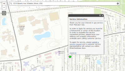
The Gas Service Lookup solution is a public facing mapping application that allows the public to learn if gas service is provided at their location. This app can be embedded on the utility's website and not used as a stand-alone app. The utility can optionally use this app as a marketing or customer service tool by enabling the request tracking feature to store the location of each point used in the service lookup.
Requirements
Gas Service Lookup requires specific technical experience and software.
| Requirement | Description |
| Software |
Solution deployment
Solution hosting
|
| Applications |
|
What you get
When you deploy Gas Service Lookup, you'll find the following:
| Item | Name | Description |
| Application | Gas Service Lookup | An application used by the public to view if gas service is available at a user's location. |
| Map | Gas Service Lookup | A map used by the public to view the availability of gas service. |
| Feature layer | Gas Service Area | A feature layer used to store service area information. |
| Request Tracking | A feature layer used to store the location that users of the Gas Service Lookup have searched for. |
What's new
Below are the release dates and notes for Gas Service Lookup.
| Date | Description |
| November 2020 |
|
| December 2019 |
|
| June 2017 |
|
| January 2017 |
|
| December 2014 |
|
| January 2014 |
|