In order to use the Utility Isolation Trace application, a geoprocessing service is required. Before publishing the geoprocessing service, you will first need to generate the Isolation Trace toolbox. Once you have the Isolation Trace tool configured for your organization, you can trace the network and publish the geoprocessing service to ArcGIS Server.
IsolationTrace geoprocessing service
To publish the IsolationTrace geoprocessing service, complete the following steps:
- Open the IsolationTrace.mxd and expand the IsolationTrace geoprocessing toolbox.
- Browse to IsolationTrace.pyt and open the Isolation Trace tool. Add a flag location, and run the tool.
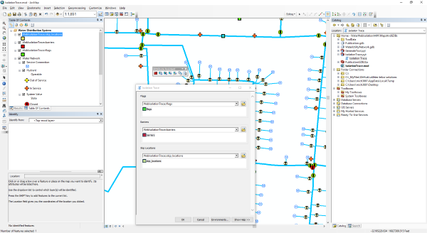
Running the IsolationTrace geoprocessing model in ArcMap. - After the tool has run, share as a Geoprocessing Service to ArcGIS Server using the default parameters in the Service Editor.
- Open the ArcGIS Services Directory and record the REST endpoints for the service.