The Water Isolation Trace app requires a map with a view of the water network, outage details, and (optionally) the location of leaks collected in the field. You can create an Isolation Trace map, share it with the appropriate groups in your organization, and then configure the Isolation Trace application using Web AppBuilder for ArcGIS (Developer Edition). Staff can then use the Water Isolation Trace app to determine which valves to close and the affected area in the event of a main break or service shutdown.
Isolation trace map
To create the Isolation Trace map, complete the following steps:
- Sign in to your ArcGIS organization.
- Create a web map that can be used in the water isolation trace, by completing the following workflows:
- Choose a basemap.
- Add the water distribution network, outage details, and leak investigator services to the map.
- Configure the outage area layer pop-up properties.
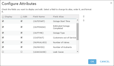
An example pop-up configuration for the outage area layer - Enable and configure the water network layers pop-up properties.
- Configure the leak report layer pop-up properties.
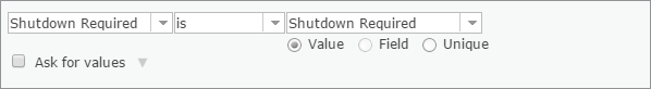
- Filter the Leak Report layer to only display reported leaks that require shutdown.
- Save the map.
- Share the map with the appropriate group in your organization. For example, share with the Field & Facilities Maintenance group.