The Pre-Incident Plan Locator application requires a map to locate Fire Pre-Incident Plans. Create the Pre-Incident Plan Locator map and share it with your Fire service personnel.
Pre-Incident Plan Locator map
To create an Pre-Incident Plan Locator map, complete the following steps:
- Sign in to your ArcGIS organization.
- Create a map to allow fire personal to locate pre-incident plans and related fire protection assets near a given location, by completing the following workflows:
- Choose a basemap.
- Add the FirePreIncidentPlans layer to the map and remove FirePreIncidentPlans - from the layers name.
- Configure pop-up for all of the layers using the list of field attributes option.
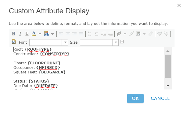
An example of a pop-up configuration - Save the map as Pre-Incident Plan Locator and add the following tags and summary:
- Tags: Fire Service, PreIncident Planning, Local Government
- Summary: A map used in the Pre-Incident Plan Locator application to locate fire pre-incident plans and related fire protection assets near a given location.
- Disable editing on each of the layers.
- Save the map and share it with fire service personnel.
- Browse to the map and edit the item details:
- Thumbnail image: Your image.
- Description: A map used in the Pre-Incident Plan Locator application to locate fire pre-incident plans and related fire protection assets near a given location.
- Set map options by disabling Routing and Measure Tool. Under Find Locations, enable both By Address and By Layer, before choosing a feature layer you want to be searchable.