This item has been moved to mature support. Please see What's new for more information.
Overview
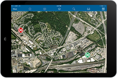
Railroad Inspection is a configuration of ArcGIS Online and ArcGIS Collector application. The configuration supports field-based collection of railroad crossing inspection information. This configuration will enable inspectors to rapidly inspect sites they are responsible for and post their information quickly.
Requirements
Railroad Inspection requires specific software.
| Requirement | Description |
| Software | Map authoring
GIS service hosting
|
| Applications |
|
What you get
When you download Railroad Inspection, the download includes the following:
| Directory | Item | Description |
| MapsandGeodatabase | RailroadInspections.mxd | A map document used to publish the RailroadInspections service. |
| StateGovernment.gdb | State Government geodatabase with sample data. |
What's new
Below are the release dates and notes for Railroad Inspection.
| Date | Description |
| September 2018 |
|
| January 2017 |
|
| September 2016 |
|
| June 2014 |
|
You may be interested in
ArcGIS for State Government includes several related maps and apps that also can be configured in your organization: