Overview
Water Quality Inspections is a configuration of ArcGIS Survey123 to conduct collect water quality information in the field. ArcGIS Dashboards can then be used to monitor and track water quality information.
Water Quality Inspections can be used by natural resources field staff to collect water quality information at designated sampling sites. Collecting water quality information also enables staff to review and monitor condition and take the appropriate remediation action.
Requirements
To deploy Water Quality Inspections with the ArcGIS Solutions Deployment Tool requires specific software.
| Requirement | Description |
| Software |
Solution deployment
Solution hosting
|
| Applications |
|
What you get
Water Inspections can be deployed in your ArcGIS organization without downloading the solution. When you deploy Water Inspections in your organization, you'll find the following:
| Item | Name | Description |
| Survey | Water Quality Survey | A survey used by field staff to collect water quality information at designated sampling sites. |
| Application | Water Quality Status Dashboard (Automated deployment) | An application used by natural resources staff to track water quality and take appropriate remediation actions when necessary. |
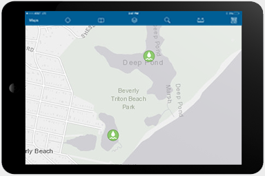
| Map | Water Quality Inspections | A map used in the Water Quality Status Dashboard and to collect water quality information at designated sampling sites. |
| Feature layer | WaterQuality | A feature layer used to store water quality inspections. |
What's new
Below are the release dates and notes for Water Quality Inspections.
| Date | Description |
| November 2020 |
|
| June 2018 |
|
| April 2018 |
|
| March 2017 |
|
| January 2017 |
|
| December 2016 |
|
| September 2016 |
|
| April 2014 |
|