The ArcGIS Solutions website will no longer be available after September 1, 2025. See the latest documentation.
This item has been moved to mature support. Please see What's new for more information.
Overview
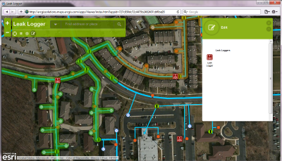
The Leak Logger Analysis solution provides a water utility tools to plan the placement of leak listening devices, manage information reported by the devices, and be notified when a leak is reported.
This solution includes a series of services, maps, and apps for use throughout your utility's organization.
Requirements
Leak Logger Analysis requires specific technical experience and software.
| Requirement | Description |
| Software | Map authoring
GeoEvent service hosting
Map service hosting
Application hosting
|
| Applications |
|
| Prerequisites |
What you get
When you download Leak Logger Analysis, you'll find the following in the zip file:
| Directory | Item | Description |
| Application | A folder containing a set of Python 2.7 scripts to create and update the required services, maps, and apps in your organization. These scripts utilize the Automated Setup & Reporting tools. | |
| Maps and GDBs | Symbols | A folder containing layer files and icons for the maps. |
| LeakLogger.gdb | A sample geodatabase with the Leak Logger schemas. | |
| WaterDistributionNetwork.gdb | A sample geodatabase with water network data from Naperville, Illinois. | |
| Leak Logger Planner.tbx | A toolbox with tools used for planning the placement of leak loggers. | |
| LeakLoggerPlanner.mxd | A map document used to plan the placement of the leak loggers. | |
| LeakLoggerResults.mxd | A map document used to publish the Leak Logger service. | |
| Icons | A folder containing icons for the services, maps, and apps. | |
What's new
Below are the release dates and notes for Leak Logger Analysis.
| Date | Description |
| June 2020 |
|
| June 2019 |
|
| February 2016 |
|
| August 2015 |
|
| July 2015 |
|