The ArcGIS Solutions website will no longer be available after September 1, 2025. See the latest documentation.
This item has been moved to mature support. Please see What's new for more information.
Overview
Due to aging infrastructure, water utilities face the challenge of responding to leaks in order to limit non-revenue water loss. The Water Leak Investigator solution can be used by field technicians to record the location and severity of leaks in the water network. In addition to collecting leak information, utilities can enable real time notifications to ensure that the appropriate members of their organization are notified when a leak requiring a shutdown is reported.
Requirements
Water Leak Investigator requires specific technical experience and software.
| Requirement | Description |
| Software | Solution deployment
Solution hosting
|
| Applications |
|
What you get
When you deploy Water Leak Investigator, you'll find the following:
| Item | Name | Description |
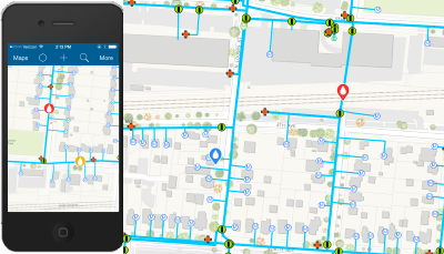
| Map | Water Leak Investigator | A map used by field technicians to record water leaks using Collector for ArcGIS. |
| Feature layer | Leak Investigator | A feature layer used to store the location of leaks. |
What's new
Below are the release dates and notes for Water Leak Investigator.
| Date | Description |
| March 2019 |
|
| June 2017 |
|
| January 2017 |
|
| July 2015 |
|
| June 2014 |
|
| April 2014 |
|
| March 2014 |
|
You may be interested in
Automated deployment options
With ArcGIS Pro and the ArcGIS Solutions Deployment Tool, users can now automate the deployment of this solution in their ArcGIS organization. Follow a few simple steps to quickly deploy the solution, configure it, and load your data when necessary.