Overview

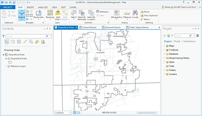
Administrative Area Data Management can be used to maintain an authoritative inventory of administrative areas (geopolitical areas, school districts and attendance zones, public safety districts, and service boundaries).
It streamlines the collection, maintenance, and use of authoritative administrative area information. that fundamentally define geopolitical responsibilities and federal funding allocations; how education dollars are allocated and where children attend school; who responds to a 911 call; and organize other services delivered by government agencies.
Typically, this information is managed by local governments and used extensively to manage local government operations. Aggregating this data in to larger geographies (county, state, or federal) helps organizations address emergency response and census administration needs.
Requirements
To deploy Administrative Area Data Management with the ArcGIS Solutions Deployment Tool requires specific software.
| Requirement | Description |
| Software |
Solution deployment and map authoring
Solution hosting
|
What you get
When you download Administrative Area Data Management, you'll find the following files:
| Item | Description |
| AdministrativeAreaDataManagement.ppkx | An ArcGIS Pro project package used to inventory and maintain administrative areas. |
What's new
Below are the release dates and notes for Administrative Area Data Management.
| Date | Description |
| June 2021 |
|
| March 2019 |
|
| June 2018 |
|
| March 2017 |
|
| June 2016 |
|