Overview
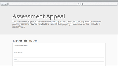
Assessment Appeal is a configuration of the GeoForm application that can be used by citizens to file a formal request for the review of their property assessment. Assessors can deploy this geo-enabled application form and quickly see where concentrations of property appeals are occurring in their community.
Typically, assessment appeals are filed when a property owner feels the value of their property is inaccurate or does not reflect market value. The appeals are then reviewed by the local assessor prior to scheduling an appointment, or hearing before a Board of Review, or Value Adjustment Board. Regular board hearings are then used to present evidence and ultimately rule on any changes to the assessed value of a given property.
Requirements
To deploy Assessment Appeal with the ArcGIS Solutions Deployment Tool requires specific software.
| Requirement | Description |
| Software |
Solution deployment
Solution hosting
|
| Application |
|
To manually deploy Assessment Appeal in your organization requires specific software.
| Requirement | Description |
| Software |
Map authoring
GIS service hosting
|
| Application |
|
What you get
Assessment Appeal can be deployed in your ArcGIS organization without downloading the solution. When you deploy Assessment Appeal in your organization, you'll find the following:
| Item | Name | Description |
| Application | Assessment Appeal | An application used by citizens to file a formal request to review their property assessment when they feel the value of their property is inaccurate. |
| Map | Assessment Appeal Filings | A map used to file a formal request for the review of a property assessment. |
| Feature layer | AssessmentAppealApplicants | A feature layer used to store formal requests filed by property owners for the review of their assessment. |
What's new
Below are the release dates and notes for Assessment Appeal.
| Date | Description |
| June 2018 |
|
| June 2017 |
|
| January 2017 |
|
| June 2016 |
|
| October 2015 |
|