Overview
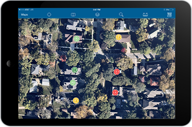
Tactical Operation Surveillance can be used to collect field intelligence that supports tactical operation plans at a given location.
Field intelligence may include notes, photos, and videos of buildings, vehicles and/or persons observed coming and going from a scene. As this information is collected in the field, it can be incorporated into the Tactical Operation Planner and Tactical Operation Dashboard.
Requirements
To deploy Tactical Operation Surveillance with the ArcGIS Solutions Deployment Tool requires specific software.
| Requirement | Description |
| Software |
Solution deployment
Solution hosting
|
| Application |
|
To manually deploy Tactical Operation Surveillance in your organization requires specific software.
| Requirement | Description |
| Software |
Map authoring
GIS service hosting
|
| Application |
|
What you get
Tactical Operation Surveillance can be deployed in your ArcGIS organization without downloading the solution. When you deploy Tactical Operation Surveillance in your organization, you'll find the following:
| Item | Name | Description |
| Map | Tactical Operation Surveillance | A map used by Law Enforcement personnel to collect Tactical Operation Plans. |
| Feature layer | TacticalOperationPlans | A feature layer used to store Tactical Operation Plans. |
What's new
Below are the release dates and notes for Tactical Operation Surveillance.
| Date | Description |
| November 2021 |
|
| December 2017 |
|
| March 2017 |
|