Overview
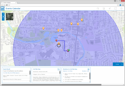

Event Locator is a configuration of ArcGIS and a JavaScript application that allows citizens and visitors to discover festivals, shows, concerts and other events occurring in a community. Citizens and visitors can check out the calendar of events, where each event is located, and then add the event to their calendar before scheduling a visit or trip.
The Event Locator application is typically used by tourism agencies, planning and economic development departments, parks departments, and/or other state government organizations to promote events in their community. Event information can be accessed by citizens and visitors from a smartphone, tablet, and desktop computer.
Requirements
Event Locator requires specific software.
| Requirement | Description |
| Software | Map authoring
GIS service hosting
Application hosting
|
| Browser compatibility | The application is optimized for display on desktop computer, tablet, and smartphone devices using the following browsers:
|
What you get
When you download the Event Locator, you'll find the following files:
| Directory | Item | Description |
| Application | EventLocator | A folder containing the Events Locator application files. |
| MapsandGeodatabase | Events.mxd | A map document used to publish the Events service. |
| StateGovernment.gdb | State Government geodatabase with sample data. |
What's new
Below are the release dates and notes for Event Locator.
| Date | Description |
| December 2017 |
|
| January 2017 |
|
| June 2016 |
|
| February 2016 |
|
| August 2015 |
|
| July 2015 |
|