The ArcGIS Solutions website will no longer be available after September 1, 2025. See the latest documentation.
This item has been moved to mature support. Please see What's new for more information.
Overview
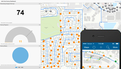
Joint Use Survey is a configuration of ArcGIS to conduct joint use surveys. With this solution, field crews are able to use a mobile device to record attachments, safety violations, and the status of assigned work. Additionally, managers at the utility are able to use a series of apps to assign work and monitor the progress of joint use inventory in the service area.
Requirements
Joint Use Survey requires specific technical experience and software.
| Requirement | Description |
| Software |
Map authoring
Map service hosting
Application hosting
|
| Applications |
|
| Prerequisite |
|
What you get
When you download the Joint Use Survey, you'll find the following in the zip file:
| Directory | Item | Description |
| Maps and GDBs | ElectricNetwork.gdb | A sample geodatabase with sample electric network data. |
| JointUseSurvey.gdb | A sample geodatabase with joint use survey schema and sample data. | |
| ElectricNetwork.mxd | A map document used to publish the electric network service with gray-scale symbology. | |
| JointUseSurvey.mxd | A map document used to publish the joint use service. | |
| JointUseSurvey.tbx | A toolbox with a tool to load pole data to the joint use survey schema. | |
| Icons | A folder containing icons for the services, maps, and apps. | |
What's new
Below are the release dates and notes for Joint Use Survey.
| Date | Description |
| November 2020 |
|
| September 2018 |
|
| June 2017 |
|
| December 2015 |
|
| August 2015 |
|
| December 2014 |
|
| October 2014 |
|