Overview
Pipeline operators are required to report on their gas gathering system annually. The Facility Reports for Gas Gathering solution can be used to help summarize information needed for this annual report. In addition to summarizing the report content, the results can be published to your ArcGIS organization as a service, map, and app. The summary report can also be exported out as a CSV file.
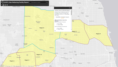
The reports include summarizations of Onshore Type A, Onshore Type B, and Offshore pipe by material, installation decade, DOT class, and nominal diameter. Additionally, this solution includes summarization reports of eliminated or repaired leaks by cause.
Warning
Please review the known issues before configuration of this solution on your data.
Requirements
Facility Reports for Gas Gathering requires specific technical experience and software.
| Requirement | Description |
| Software | Report Generation
Map service hosting
Application hosting
|
| Applications |
|
What you get
When you download Facility Reports for Gas Gathering, you'll find the following in the zip file:
| Directory | Item | Description |
| Application | A folder containing a set of Python 2.7 scripts to create and update the required services, maps, and apps in your organization. These scripts utilize the Automated Setup & Reporting tools. | |
| Maps and GDBs | GatheringReports.gdb | A sample geodatabase with the schema for the gathering reports. |
| NapervilleGas.gdb | A sample geodatabase with gas network and reporting data. | |
| ReportProcessing.tbx | A toolbox with tools used to pre-process gas network data for reporting. | |
| GasGatheringReport.mxd | A map document used to publish the gathering reports. | |
What's new
Below are the release dates and notes for Facility Reports for Gas Gathering.
| Date | Description |
| November 2020 |
|
| October 2019 |
|
| June 2017 |
|
| June 2016 |
|
| February 2016 |
|
| December 2015 |
|
Known issues
- The automated setup uses ArcREST, which does not support application and enterprise logins.
- When publishing to Portal for ArcGIS, the Hosting Server must use an ArcGIS Data Store as a managed geodatabase.
- When publishing to Portal for ArcGIS with an ArcGIS Data Store Hosting Server, field names will be auto converted to lowercase. The tools will update the maps created, but apps are not updated to handle this conversion.
- The script is delivered using relative paths. To use this without changing to absolute paths, you need to have python.exe as the default file extension for .py files and the path to Python in your systems path variable.