This item has been moved to mature support. Please see What's new for more information.
Overview
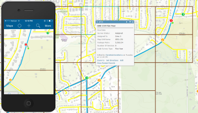
The Leak Survey Collector allows field crews to conduct leak surveys using the ArcGIS Collector app. Using this solution, field technicians can view, add, and update data associated with their assigned leak surveys. Using the Leak Survey Collector, users are able to do the following:
- View detailed gas network and leak survey information
- Update leak survey status and reports
- Report gas leaks and ad hoc issues from the field
Requirements
Leak Survey Collector requires specific technical experience and software.
| Requirement | Description |
| Software | Map Authoring
Map service hosting
Application hosting
|
| Applications |
|
| Prerequisites |
|
What you get
When you download Leak Survey Collector, you'll find the following in the zip file:
| Directory | Item | Description |
| Maps and GDBs | LeakSurvey.gdb | A sample geodatabase with the leak survey schema with sample data. |
| LeakSurveyCollectorMap.mxd | A map document used to publish the leak survey service. | |
| Icons | A folder containing icons for the services, maps, and apps. | |
What's new
Below are the release dates and notes for Leak Survey Collector.
| Date | Description |
| November 2020 |
|
| February 2016 |
|
| July 2015 |
|