Capital Project Planning allows local government staff to define capital projects, coordinate project schedules, track project performance, and share project status with key stakeholders and the general public. The following maps must be configured to manage capital planning in your community:
- Project Planning
- Project Review
- Pavement Moratoriums
- External Agency Projects
- Capital Improvement Plan
Project Planning maps
To create the ArcGIS Online Project Planning maps for water, sewer, stormwater, and transportation assets, complete the following steps:
- Sign in to your ArcGIS Online organization.
- Create a map to plan water, sewer, stormwater, and transportation projects, by completing the following workflows:
- Choose a basemap.
- Add the InfrastructureProjects layer to the map and rename it to Water Distribution Projects.
-
Configure pop-up for the Water Distribution Projects layer using the list of field attributes option.
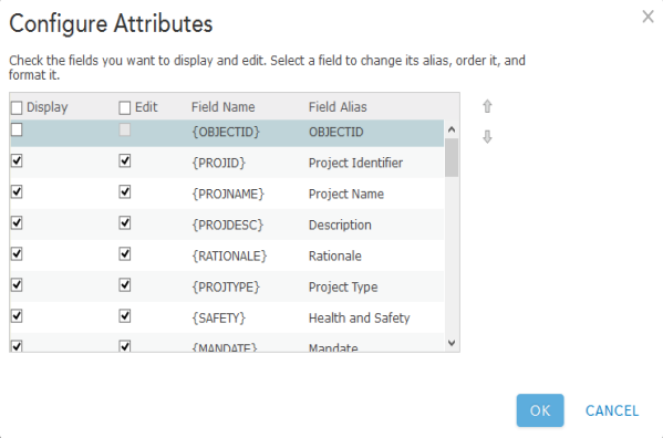
An example of a pop-up configuration - Save the map as Water Distribution Projects, then type in tags that describe your map and enter a summary.
- Apply a filter to the Water Distribution Projects layer, by using the following expression: Project Type Is Water Distribution.
- Save the map and share it with your Public Works Services group.
- Browse to the Water Distribution Projects map and edit the item details.
- Repeat steps 2 through 5 above for each asset you'd like to include in your Capital Improvement Plan.
Project Review maps
To create the ArcGIS Online Project Review maps, complete the following steps:
- Sign in to your ArcGIS Online organization.
- Create a map for plan review staff to review proposed capital projects, by completing the following workflows:
- Choose a basemap.
- Add the InfrastructureProjects layer to the map.
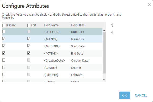
- Configure pop-up for the InfrastructureProjects layer using the list of field attributes option.
- Save the map as Capital Projects - Plan Review, then type in tags that describe your map and enter a summary.
- Apply a filter to the InfrastructureProjects layer, by using the following expression: Project Status Is Review and Analysis.
- Enable Time Animation on the InfrastructureProjects layer.
- Save the map and share it with your Capital Project Planning group.
- Browse to the Capital Projects - Plan Review map and edit the item details.
- Create a map for executives and oversight committees to review proposed capital projects, by completing the following workflows:
- Choose a basemap.
- Add the InfrastructureProjects layer to the map.
- Configure pop-up for the InfrastructureProjects layer using the list of field attributes option.
- Save the map as Capital Projects - Executive Review, then type in tags that describe your map and enter a summary.
- Apply a filter to the InfrastructureProjects layer, by using the following expression: Project Status Is Executive Approval.
- Save the map and share it with your Capital Project Planning group.
- Browse to the Capital Projects - Executive Review map and edit the item details.
Pavement Moratoriums map
To create an ArcGIS Online Pavement Moratorium map, complete the following steps:
- Sign in to your ArcGIS Online organization.
- Create a map to inventory pavement moratoriums and share them with interested parties, by completing the following workflows:
- Choose a basemap.
- Add the PavementMoratoriums layer to the map.
- Configure pop-up for the PavementMoratoriums layer using the list of field attributes option.
An example of a pop-up configuration - Save the map as Pavement Moratoriums, then type in tags that describe your map and enter a summary.
- Share the map with your Capital Project Planning group.
- Browse to the Pavement Moratoriums map and edit the item details.
External Agency Projects map
To create an ArcGIS Online External Agency Projects map, complete the following steps:
- Sign in to your ArcGIS Online organization.
- Create a map that can be used by external agencies to communicate projects they have planned in your community, by completing the following workflows:
- Choose a basemap.
- Add the ExternalAgencyProjects and PavementMoratoriums layers to the map.
- Configure pop-up for the ExternalAgencyProjects and PavementMoratoriums layers using the list of field attributes option.
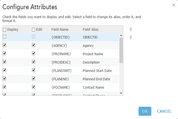
An example of a pop-up configuration - Save the map as External Agency Projects, then type in tags that describe your map and enter a summary.
- Disable editing on the PavementMoratoriums layer.
- Save the map and share it with your Capital Project Plans - External Agencies group.
- Browse to the External Agency Projects map and edit the item details.
Capital Improvement Plan map
To create an ArcGIS Online Capital Improvement Plan map, complete the following steps:
- Sign in to your ArcGIS Online organization.
- Create a map to inventory capital improvement plans and share them with interested parties, by completing the following workflows:
- Choose a basemap.
- Add the CapitalImprovementPlan layer to the map.
- Configure pop-up for the CapitalImprovementPlan layer using the list of field attributes option.
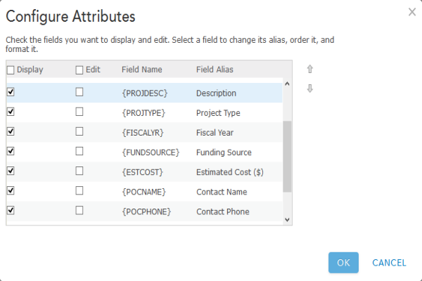
An example of a pop-up configuration - Save the map as Capital Improvement Plan, then type in tags that describe your map and enter a summary.
- Save the map and share it with your organization and everyone.
- Browse to the Capital Improvement Plan map and edit the item details.