Once the Network Trace widget has been configured, you can use the widget to run a geoprocessing service (such as a water isolation trace), view the results, re-run a trace, and save the results to a layer or CSV.
To use the Network Trace widget, complete the following steps:
- Click the widget icon to open the Network Trace widget.
- Add a flag location. You can also add barrier locations if known. Then click Run to run the geoprocessing service.
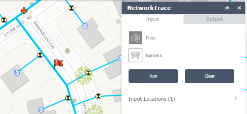
Flag location added for a water network isolation trace. - When complete, the map will zoom to the extent and display the results on the map. You will also be able to view a summarization of the results and the specific outputs results.
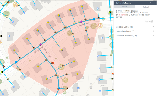
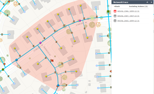
Results of the water network isolation trace. - If any of the outputs have been set to skippable, features can be marked as barriers. To disable a feature, click the icon next to the feature and re-run the trace.
Valve disabled (now barrier when re-run) for a water network isolation trace. - Save and clear the results. The map will now include the results of the trace in a feature service.
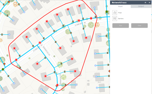
The final map view of the water isolation trace when results are saved.