To use the Facility Reports for Gas Gathering solution with your gathering system data, the report schemas need to be projected to match the coordinate system of your service area.
To project the sample feature datasets, complete the following steps:
- In ArcCatalog, navigate to the Maps and GDBs folder.
- Rename the sample geodatabase from GatheringReports.gdb to SampleGatheringReports.gdb.
- In the Maps and GDB folder, create a new file geodatabase named GatheringReports. This will ensure the data paths in the map documents and configuration files will point to your projected datasets.
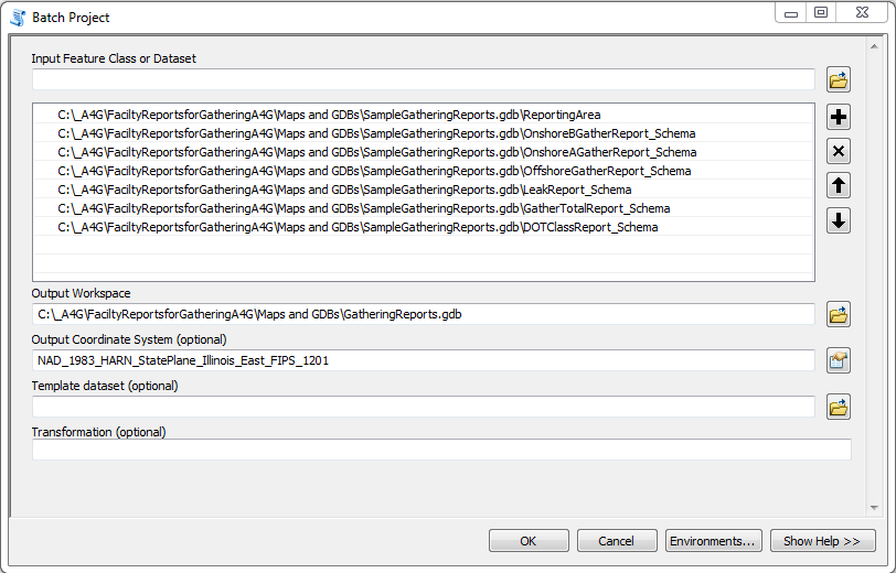
- In ArcCatalog, navigate to ArcToolbox > Data Management Tools > Projections and Transformations.
- Open the Batch Project tool.
- Select the contents of the SampleGatheringReports.gdb as the input feature datasets, output workspace to the new GatheringReports.gdb, and the coordinate system of your data as the output coordinate system.
- When complete, the feature classes projected in your coordinate system will be in the GatheringReports.gdb.