The ReplacementProjectPolygon geoprocessing model can be used to create the gas main replacement project areas and calculate the municipality, miles of main, and project year fields.
To configure the geoprocessing model to use with your data, complete the following steps:
- In ArcCatalog or ArcMap, browse to Maps and GDBs > GasMainReplacement.tbx.
- Open the ReplacementProjectPolygon geoprocessing model.
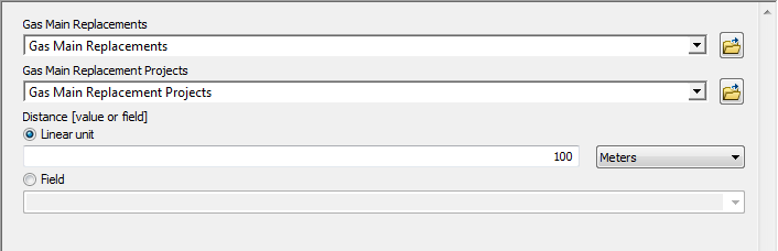
- Update the Gas Main Replacements and Gas Main Replacement Projects parameters for your main replacement feature classes.
- To create smaller or larger project polygons, update the distance parameter.
- Run the geoprocessing model to create the project polygons.