Overview
Data Reviewer for Basemaps provides preconfigured ArcGIS Data Reviewer for Desktop batch jobs (.rbj) that can be used to validate, maintain, and improve the integrity of basemap data.
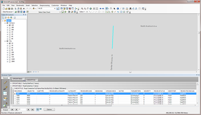
Data Reviewer provides a set of tools to simplify many aspects of automated and visual data quality control. Data Reviewer provides out-of-the-box checks that can be run individually, grouped into batch jobs (.rbj files), or run as a scheduled service. The batch jobs provided with Data Reviewer for Basemaps are configured to work with the Local Government Information Model.
Requirements
Data Reviewer for Basemaps requires specific software.
| Requirements |
Description |
| Software |
Map authoring
- ArcMap 10.4 - 10.6
- ArcGIS Data Reviewer for Desktop extension 10.4 - 10.6, or
- Esri Production Mapping extension 10.4 - 10.6
- Microsoft Excel (for viewing reports)
|
What you get
When you download Data Reviewer for Basemaps, you'll find the following files:
| Directory |
Item |
Description |
| Application |
10.4 |
A folder containing ArcGIS 10.4 Data Reviewer batch job file with preconfigured checks for performing quality control on basemap data. |
| 10.5 |
A folder containing ArcGIS 10.5 Data Reviewer batch job file with preconfigured checks for performing quality control on basemap data. |
| 10.6 |
A folder containing ArcGIS 10.6 Data Reviewer batch job file with preconfigured checks for performing quality control on basemap data. |
| MapsandGeodatabase |
DataReviewer.gdb |
A sample Reviewer workspace used to store error results. |
What's new
Below are the release dates and notes for Data Reviewer for Basemaps.
| Date |
Description |
| June 2018 |
- Data Reviewer for Basemaps has been moved to mature support.
|
| June 2017 |
- Retired the following checks from the Basemaps batch job:
- Parking Space Must Have Valid Domains
- Trees Must Have Valid Domains
- Pavement Marking Point Must Have Valid Domains
- Pavement Marking Line Must Have Valid Domains
- Parking Space Must Not Have Duplicate Geometry
- Trees Must Not Have Duplicate Geometry
- Pavement Marking Point Must Not Have Duplicate Geometry
- Pavement Marking Line Must Not Have Duplicate Geometry
- Control Corner Must Not Have Duplicate Geometry
- PLSS Boundary Must Not Have Duplicate Geometry
- PLSS Section Must Not Have Duplicate Geometry
- Parking Space Space Name Must Not Be NULL Or Blank
- Control Corner Local Label Must Not Be NULL Or Blank
- PLSS Section Section Label Must Not Be NULL Or Blank
|
| September 2016 |
- Retired the following checks from the Basemaps batch job:
- Administrative Area Boundary lines Must Have Valid Domains
- Administrative Area Boundary Line Must Have Valid Subtypes
- Administrative Area Boundary Line Must Not Overlap
- Administrative Area Boundary Line Must Not Have Duplicate Geometry
- Renamed Municipal Boundary MUNIAREA Must Not Be Null to Municipal Boundary LEGALAREA Must Not Be Null and changed where clause from MUNIAREA IS NULL to LEGALAREA IS NULL.
- Renamed County Boundary COUNTYAREA Must Not Be Null to County Boundary LEGALAREA Must Not Be Null and changed where clause from MUNIAREA IS NULL to LEGALAREA IS NULL.
- Changed the data source for the following checks from AdministrativeArea to GeopoliticalArea feature class:
- Municipal Boundary Must Have Valid Domains
- County Boundary Must Not Have Duplicate Geometry
- Municipal Boundary Must Not Have Duplicate Geometry
- County Boundary Name Must Not Be NULL Or Blank
- County Boundary LEGALAREA Must Not Be Null
- Municipal Boundary LEGALAREA Must Not Be Null
- County Boundary Must Not Overlap
- Municipal Boundary Must Not Overlap
- Municipal Boundary Polygon Sliver Must Not Be Less Than 5 Sq Ft
|