This item has been moved to mature support. Please see What's new for more information.
Overview
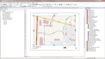
The Fire Run Book map is used by fire personnel to author map pages using Data Driven Pages and assemble them in to a larger Fire Run Book that includes a book cover, map pages, and street index into a single document suitable for printing. These map documents can be used to create a complete fire run book for individual stations or for an entire fire district.
The Fire Run Book includes a series of map documents and tools to create a street index report and assembling your Run Book in landscape and portrait orientations.
Requirements
Fire Run Book requires specific software.
| Requirement | Description |
| Software |
Map authoring
|
What you get
When you download the Fire Run Book, you'll find the following files:
| Directory | Item | Description |
| Application | Output Folder | A folder containing the Fire Run Book cover page and index page, and storing the final Fire Run Book. |
| MapsandGeodatabase | FireRunBook_Landscape.mxd | A map document map used to author the Fire Run Book in a landscape orientation. |
| FireRunBook_Portait.mxd | A map document map used to author the Fire Run Book in a portrait orientation. | |
| FireRunBookCover_Landscape.mxd | A map document map used to author the Fire Run Book Cover in a landscape orientation. | |
| FireRunBookCover_Portrait.mxd | A map document map used to author the Fire Run Book Cover in a portrait orientation. | |
| StationMapIndex_Landscape.mxd | A map document map used to author the Station Map Index in a landscape orientation. | |
| StationMapIndex_Portrait.mxd | A map document map used to author the Station Map Index in a portrait orientation. | |
| FireRunBook_Landscape.pdf | A sample Fire Run Book landscape map book. | |
| FireRunBook_Portrait.pdf | A sample Fire Run Book portrait map book. | |
| LocalGovernment.tbx | A toolbox with tools for building a street index and assembling the Fire Run Book. | |
| LocalGovernment.gdb | ArcGIS for Local Government geodatabase with content from the City of Naperville, Illinois. |
What's new
Below are the release dates and notes for Fire Run Book.
| Date | Description |
| April 2018 |
|
| June 2016 |
|
| February 2016 |
|
| July 2015 |
|
| December 2014 |
|
| June 2014 |
|
| June 2013 |
|
You may be interested in
ArcGIS for Local Government includes several related maps and apps that also can be configured in your organization: