The Publish Proposed Development ArcGIS Pro project can be used by local government staff to publish a 3D scene that contains new development plans and share the proposed plans with other members in their organization.
3D models in many common formats (for example, .dae, .flt, .3ds, .wrl) can be imported directly and placed into the scene. Alternatively, you can load a 3D model from a multipatch feature class and hide existing features such as buildings and trees that overlap with the new development before publishing.
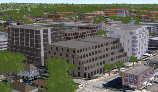
Publish Proposed Development
To publish, or add, a proposed development to the scene, complete the following steps:
- Open the PublishProposedDevelopment.ppkx in ArcGIS Pro.
- Sign in to your Portal for ArcGIS organization and make it the active portal.
- On the Project pane, expand the Tasks folder, then double-click on the Add Proposed Development task to add the new development to the scene. Choose the correct task, depending on the format that the proposed development is in:
- Use the Load Proposed Development task (as multipatch) if your proposed development is already stored in the geodatabase as a multipatch feature class.
- Use the Insert Proposed Development (as 3D model) task if you have the development in any of the supported 3D formats (*.dae, *.flt, *.3ds, *.wrl). Optionally, modify the inserted model by moving, scaling, or rotating it.
- Use the Hide Existing Features task to hide features of existing layers that overlap with the proposed development.
- Double-click on the Publish Proposed Development task in the Project pane to share the Proposed Development to your Portal for ArcGIS account.
Author Proposed Development Scene
To author a Proposed Development Scene, complete the following steps:
- Sign in to your ArcGIS Online organization.
- Create a Scene using the 3D layers you published.
- Optionally, add an elevation service to the scene. For more information on publishing elevation layers, see the Local Government 3D Basemaps topic.
- Save the scene and share it with your organization.
Once you have finished publishing your scene, you can also share it with the Living Atlas.