The ArcGIS Solutions website will no longer be available after September 1, 2025. See the latest documentation.
This item has been moved to mature support. Please see What's new for more information.
Overview
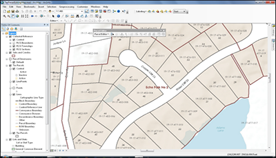
The Tax Parcel Editing map organizes the survey framework, subdivisions, lots, tax parcels and encumbrances in a fabric data model that can be maintained with the ArcGIS for Desktop Parcel Editor toolbar.
It is an editing map that can be used by local government mapping technicians in an Assessors Office, Public Works agency, Register Of Deeds Office, or any other agency responsible for managing land records information.
Requirements
Tax Parcel Editing requires specific software.
| Requirement | Description |
| Software | Map authoring
|
What you get
When you download Tax Parcel Editing, you'll find the following files:
| Directory | Item | Description |
| Application | Migration Tools | A folder containing tools for migrating data to a staging geodatabase and parcel fabric. |
| Parcel Publishing | A folder containing the Python script and toolbox used to create the TaxParcel feature class in the ParcelPublishing feature dataset. | |
| Condo Tools | A folder containing the Python script and toolbox used by parcel editors to create condominium records related to a single parcel geometry. | |
| AttributeAssistant.esriAddin | An ArcMap Add-in that includes the Attribute Assistant toolbar and a series of predefined methods to automatically populate attributes (for example, parcel identifiers) when features are created and updated. | |
| MapsandGeodatabase | Source Documents | A folder containing sample descriptions of parcel edits. |
| TaxParcelEditingMap.mxd | A map document used to organize survey framework, subdivisions, lots, tax parcels and encumbrances in a fabric data model. | |
| LocalGovernment.gdb | ArcGIS for Local Government geodatabase with content from the City of Naperville, Illinois. |
What's new
Below are the release dates and notes for Tax Parcel Editing.
| Date | Description |
| February 2020 |
|
| March 2019 |
|
| June 2018 |
|
| January 2018 |
|
| March 2017 |
|
| July 2016 |
|
| June 2016 |
|
| December 2015 |
|
| July 2015 |
|
| May 2015 |
|
| December 2014 |
|
| June 2014 |
|
| September 2013 |
|