This item has been moved to mature support. Please see What's new for more information.
Overview

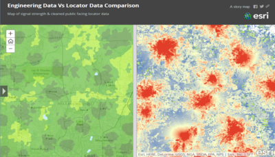
Coverage Processing can be used to process raster RF signal strength data output from RF planning tools into cleaned and simplified polygon data that is easy to visualize and understand.
Output from the solution can be shared in applications for sales and customer staff to determine signal strengths for locations within a service area. Output can also be used in applications to help customers visualize coverage in their area.
Requirements
Coverage Processing requires specific technical experience and software.
| Requirement | Description |
| Software |
Map Authoring
Map authoring
Map service hosting
|
| Prerequisites |
|
| Applications |
|
What you get
When you download the Coverage Processing model, you'll find the following in the zip file:
| Directory | Item | Description |
| Maps and GDBs | CoverageProcessing.mxd | A map document used to create and publish the coverage area. |
| CoverageProcessing.gdb | A sample geodatabase with coverage data to perform the analysis and sample results. | |
| CoverageProcessing.tbx | A toolbox with coverage processing geoprocessing models and scripts. | |
| Icons | A folder containing icons for the services, maps, and apps. | |
What's new
Below are the release dates and notes for Coverage Processing.
| Date | Description |
| November 2023 |
|
| December 2015 |
|
| March 2014 |
|