The Leak Survey Collector map can be used by field technicians to record leak surveys in the field. Using ArcGIS for Server, follow the steps below to publish the service required for Leak Survey Collector.
Leak survey
To publish the Leak Survey Collector map and register it to your ArcGIS organization, complete the following steps:
- Publish the map as a feature service using ArcGIS for Server or ArcGIS Enterprise with Create, Query, Delete, Sync, and Update capabilities.
- Sign in to your ArcGIS organization.
- Add the service to your ArcGIS organization.
- Browse to the LeakSurvey service and edit the item details:
- Title: Leak Survey Collector
- Thumbnail image:
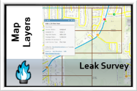
- Summary: Map layers used to conduct leak surveys.
- Description: Map layers used to conduct leak surveys. These layers include gas leaks, bar holes, dimensions, and leak survey grids.
- Tags: Leak Survey, Gas Leak