This item is now retired. Please see What's new for more information.
Overview
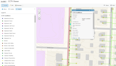
The CCTV Processor solution uses CCTV data in the NASSCO exchange format to create a point for each condition. The final map product can then be published and shared with your ArcGIS organization in order for staff to better understand vulnerability on sanitary sewer mains.
Requirements
CCTV Processor requires specific technical experience and software.
| Requirement | Description |
| Software |
Map authoring
Map service hosting
|
What you get
When you download CCTV Processor, you'll find the following in the zip file:
| Directory | Item | Description |
| Maps and GDBs | CCTVOutput.gdb | A sample geodatabase with the results of the CCTV geoprocessing tools. |
| SanitarySewerNetwork.gdb | A sample geodatabase with sewer network data from the City of Naperville, Illinois. | |
| CCTVObservations.mxd | A map document to process PACP CCTV data and publish the results. | |
| CCTVTools.tbx | A toolbox with a tool to visualize CCTV data in the NASSCO exchange format on a map. | |
| PACPSchema.xml | An XML workspace document used to create the output GDB. | |
| PACPSample.mdb | A sample Microsoft Access PACP database. | |
| Symbology | A folder containing layer files for the observation points and sewer mains. | |
| Pictures | The folder containing CCTV image files. Sample images have been provided. | |
| Videos | The folder containing CCTV video files. A sample video has been provided. | |
| Icons | A folder containing icons for the services, maps, and apps. | |
What's new
Below are the release dates and notes for CCTV Processor.
| Date | Description |
| June 2019 |
|
| June 2018 |
|
| December 2016 |
|
| September 2016 |
|
| April 2016 |
|
| December 2015 |
|
| October 2015 |
|
| July 2015 |
|
| May 2015 |
|
| December 2014 |
|
| October 2014 |
|
| June 2014 |
|
Known issues
- This solution does not support Background Geoprocessing.
- If multiple inspections are present (one upstream and one downstream) for the same main, only one of the mains will be added to the Televised Main layer.
You may be interested in