The upstream trace geoprocessing service, business locations, and resulting data can be accessed in the field with the Illicit Discharge Trace app. Follow the steps below to publish the services required.
Upstream trace
To implement Illicit Discharge Trace, complete the following steps:
- Open the IllicitTrace.mxd and expand the IllicitTrace geoprocessing toolbox.
- Open the UpstreamTrace geoprocessing model and execute the model using the tool dialog box.
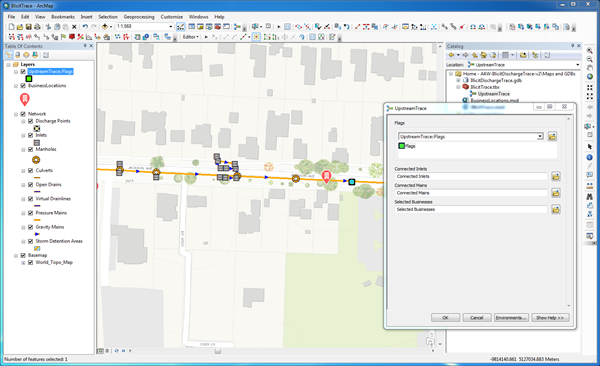
Executing the upstream trace geoprocessing model in ArcMap. Note the flag location has been added - Share as a Geoprocessing Service to ArcGIS for Server using the default parameters in the Service Editor.
- Open the ArcGIS Services Directory and record the REST endpoint for the service.
Business location
The business locations are used in the Illicit Discharge Trace app to determine potential polluters. To publish the Business Locations map and add it to your ArcGIS organization, select a deployment method and complete the following steps:
- Publish the BusinessLocations.mxd as a feature service using one of the following deployment methods:
- Sign in to your ArcGIS organization.
- Browse to the BusinessLocations service and edit the item details:
- Title: BusinessLocations
-
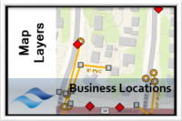
Thumbnail Image:
- Summary: A service to display business locations within the service area.
- Description: Map layer with known business locations within the service area. These businesses are used within the Illicit Discharge Trace application.
- Tags: Stormwater, Businesses, Illicit Discharge
Potential Businesses
The potential businesses service is used in the Illicit Discharge Trace app to save potential polluters. To publish the Potential Businesses map and add it to your ArcGIS organization, select a deployment method and complete the following steps:
- Publish the Potential Businesses.mxd with the Create, Delete, Query, and Update capabilities enabled using one of the following deployment methods:
- Sign in to your ArcGIS organization.
- Browse to the PotentialBusinesses service and edit the item details:
- Title: Potential Businesses
-
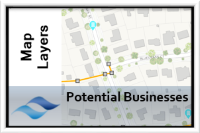
Thumbnail Image:
- Summary: A service to save the results of the illicit trace.
- Description: Map layer to save the potential polluters returned by the illicit trace app.
- Tags: Stormwater, Businesses, Illicit Discharge