The Outages map shares the electric system's status with the public. You can configure the map, and share with the public embedded on your utility's website or in an ArcGIS Online configurable application template.
Outages map
To create an Outages map in your ArcGIS organization, complete the following steps:
- Sign in to your ArcGIS organization.
- Create a map that can be used by the public to view outage information, by completing the following workflow:
- Choose a basemap.
- Add the Outages service to the map.
- Change the style of the electric outage layer to a transparency of 30 percent.
- Configure the out-of-service customers by region layer pop-up properties.
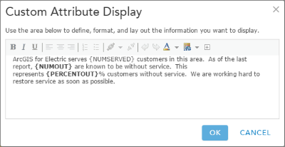
An example of the out-of-service customers by region layer pop-up configuration - Configure the outage service area layer pop-up properties.
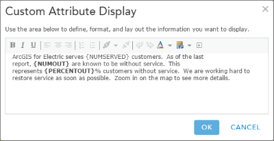
An example of the service area layer pop-up configuration - Remove the pop-ups from the outage report summaries layers.
- Save the map.
- Include media in the out-of-service customers by region layer pop-up by adding a pie chart.
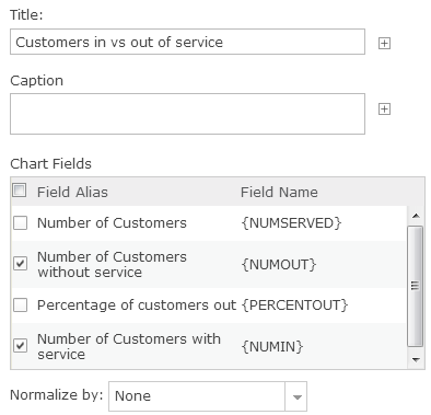
An example of the layer pop-up pie chart properties - Share the map with everyone and Public Maps & Apps group.