Fire Run Book can be used to create a map book for each station or for the entire district. In large fire districts it may be more manageable to create a fire run book for the response area of each fire station. Units assigned to another station or mutual aid partners can share their fire run books as needed.
An index map helps orient readers to where each map page is located within a fire station response area. In the example below, the Lake Osborne Complex can be seen on page U11.
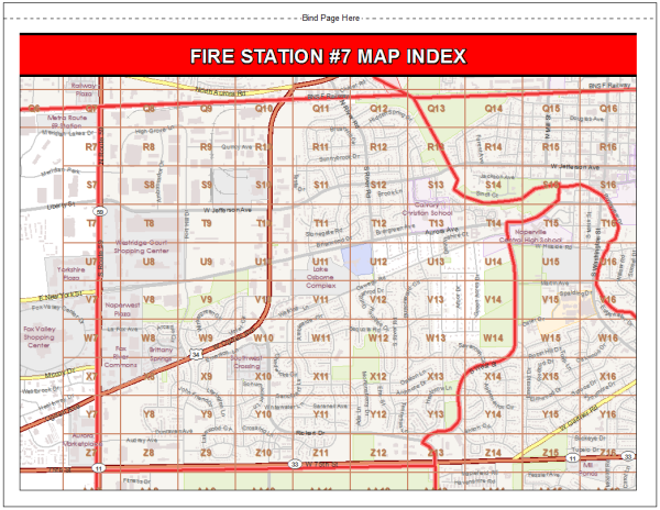
An index page is typically placed after the front cover of a fire run book for quick reference.
To create a map index page, complete the following steps:
- In the StationMapIndex_Landscape.mxd or StationMapIndex_Portrait.mxd click the Data Driven Pages Setup button on the Data Driven Pages toolbar.
- Click the Definition tab, do the following:
- Check the Enable Data Driven Pages check box.
- Set Layer > Response Area.
- Set Name Field > District Name.
- Set Sort Field > District Name.
- Click the Extent tab, do the following:
- Choose Best Fit.
- Type 100% to set the Margin Size.
- Type 110% to set Round Scale to Nearest.
- Click OK.
- Click the Layout View button.
Once Data Driven Pages is set up, you can navigate the map book pages by map sheet name or page number.
Export Data Driven Pages
To export the index map, complete the following steps:
- Click File > Export Map and set Save as type to PDF.
- Type a name for file and save it to the Application\Output folder.
- In the Export Map dialog box, click Options.
- On the General tab, for Resolution, type 300.
- On the Pages tab, to export only the current index map, click the Current button to export a PDF file of each index page separately.
- Click Save.