Adopta consumes maps that are accessible to the general public and named users in your ArcGIS Online organization. Create an Adopta map for your catch basin maintenance program and share it with the general public so they can monitor, report, and care for assets throughout your community.
Catch Basin map
To create an asset maintenance program map for catch basins, complete the following steps:
- Sign in to your ArcGIS organization.
-
Create a map to display the required asset layer, by completing the following workflow:
- Choose a basemap.
- Add the CatchBasins layer to the map.
- Configure pop-up for the CatchBasins layer using the custom attribute display option.
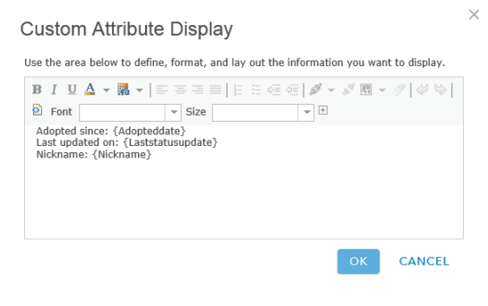
An example of a pop-up configuration - Save the map Catch Basins and add the following tags and enter a summary:
- Tags: Local Government, Adopta, Catch Basins
- Share the map with everyone.
- Browse to the map and edit the item details:
- Thumbnail image: Your image.
- Description: This map is used for the Adopta application.